File:Istanbul TMA VFR Chart.jpg
Jump to navigation
Jump to search
Size of this preview: 800 × 488 pixels. Other resolution: 1,366 × 834 pixels.
Original file (1,366 × 834 pixels, file size: 759 KB, MIME type: image/jpeg)
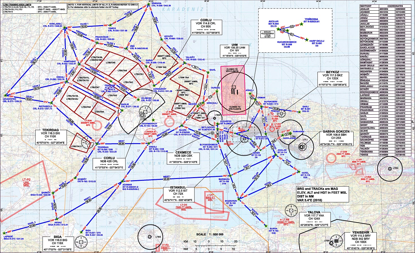
This AIP chart shows the VFR routes, waypoints and may more of the Istanbul TMA
File history
Click on a date/time to view the file as it appeared at that time.
| Date/Time | Thumbnail | Dimensions | User | Comment | |
|---|---|---|---|---|---|
| current | 19:13, 11 January 2024 | | 1,366 × 834 (759 KB) | Trvacc (talk | contribs) |
You cannot overwrite this file.
File usage
There are no pages that use this file.